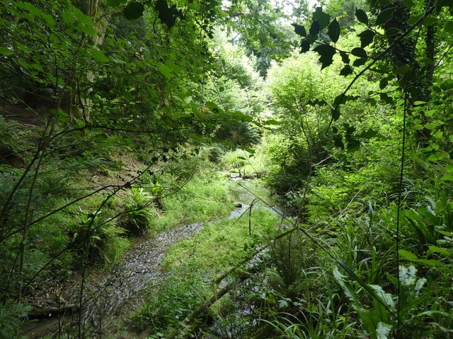
The Chalk Stream
r2: Lakes rivers and streams
|
|
|
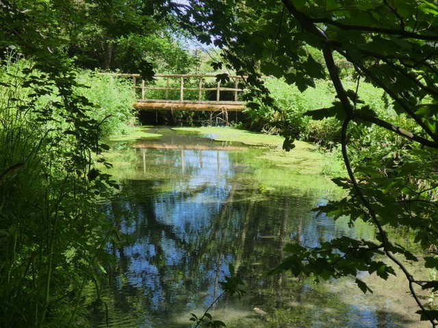
The springs rising from the base of the Downs in Beechwood Lane merge to form the stream which flows through the ghyll in Botany Bay. In the stream is a small population of wild Brown Trout, many Bullheads and riverfly larvae. The stream is surveyed regularly for The Riverfly Partnership. Riverflies, along with other freshwater invertebrates, are at the heart of the freshwater ecosystem and are a vital link in the aquatic food chain. Their common characteristics of limited mobility, relatively long life cycle, presence throughout the year and specific tolerances to changes in environmental conditions make them good biotic indicators of water quality and useful indicators of change in local environmental conditions such as pollution, siltation and low flows.
The Riverfly Partnership interest focuses on three key groups of riverflies: the up-wing flies or mayflies (Ephemeroptera), caddisflies or sedges (Trichoptera) and stoneflies (Plecoptera).
Advised by Andy Thomas from The Wild Trout Trust, we improved the flow of the stream, creating pinch points to form spawning areas for the brown trout. In 2017 Botany Bay received an award from The Wild Trout Trust for the restoration project.
|
|
The Fishing Lake
r1b: Mesotrophic lake
|
|
|
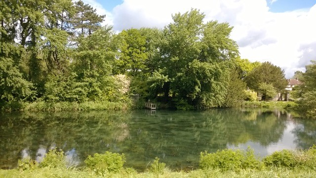
Portsmouth Services Fly Fishing Association (PSFFA) has leased the lake since 2007. Since that time their volunteers have helped with many of the improvements to Botany Bay: initially helping to clear the infrastructure from the old fish farm, enhancing the stream bed for the small community of wild trout, and enabling the fish passage to the stream’s upper reaches of clear gravel to spawn. The lake is stocked with triploid Rainbow Trout that are unable to breed. This allows the diploid native Brown Trout to thrive in this unique environment, whilst providing adequate fishing for members of PSFFA. The rainbows, averaging 1.5 to 2lbs, are stocked according to its usage, the browns are always carefully returned. The use of barbless hooks is encouraged. Native brown trout are now regularly caught of about 1lb, showing the fishing/environmental balance; a fine example of where the fishing and environmental interests coincide.
|
|
The Still Ponds
r1a: Eutrophic standing water
|
|
|
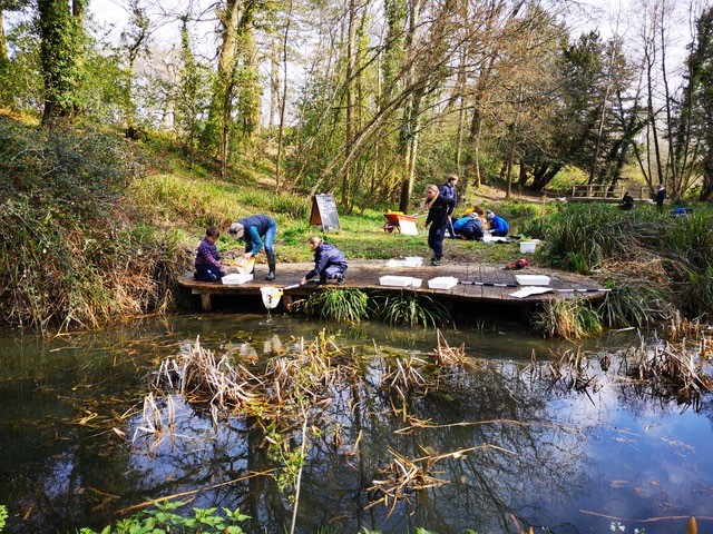
There are six still ponds on site which were originally dug out for the fish farm. These deep steep sided fish ponds have been re-profiled to increase their diversity, creating ponds of differing sizes and depths with shallow edges and undulations. We have constructed a dipping platform on one of the ponds and have regular visits from school groups for pond dipping. Toads, frogs, palmate newts, dragonfly and damselfly nymphs can be found in these ponds.
|
|
The Lake Edges
f2d: Aquatic marginal vegetation
|
|

|
The margins of the stream and lake are largely steep, so that there is little room for the development of emergent vegetation and this is dominated by Hemlock Water Dropwort and Horsetail. To provide additional opportunity for other riparian species, a small number of bankside areas on the sunny northside of the lake have been dug out to encourage a variety of emergent plants to flourish. Species introduced to these areas include Purple Loosestrife, Marsh Marigold, Ragged Robin, Meadowsweet and Devil’s-bit Scabious.
|
|
The Meadow
g2a: Lowland Calcareous grassland
|
|
|
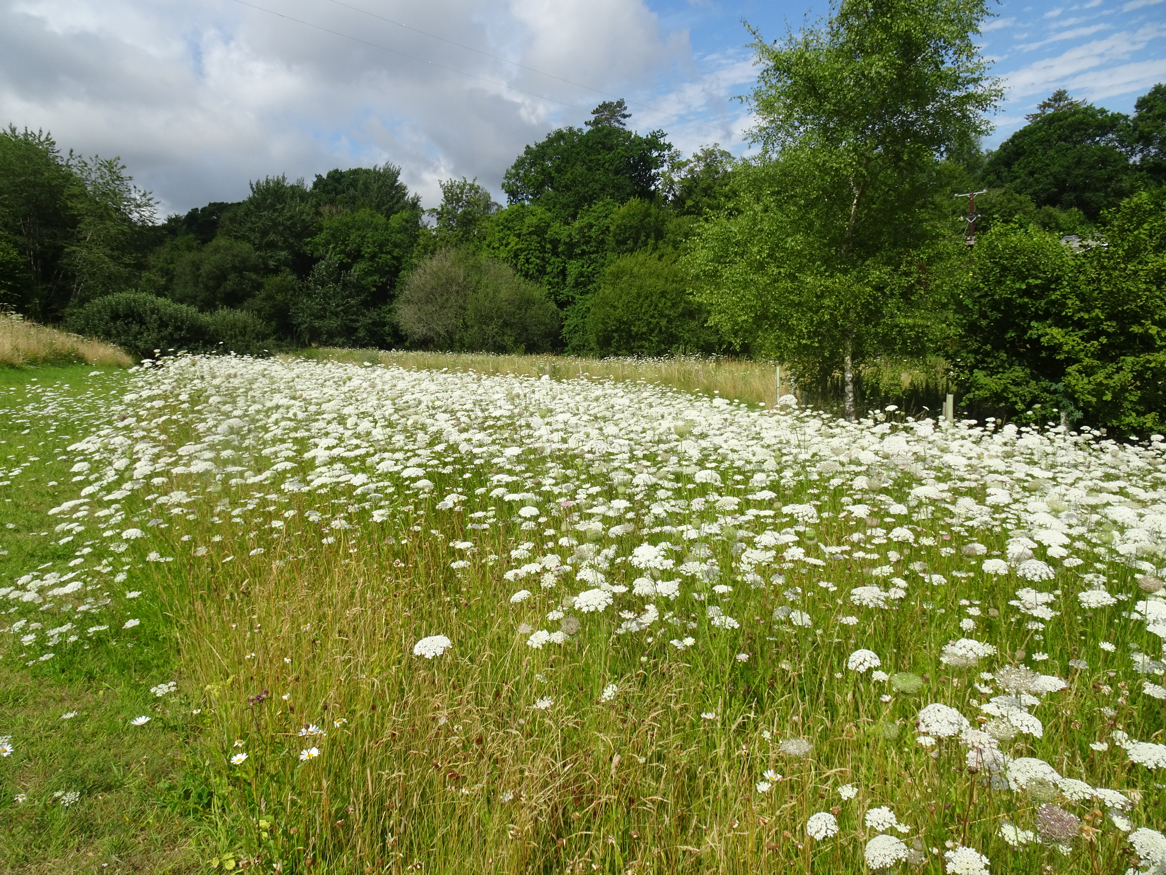
In 2019 part of the meadow was stripped of turf and some of the topsoil to remove the coarse grasses present and decrease its nutrient level to make it suitable for sowing wildflower seeds. This was done because the meadow sward consisted only of coarse grasses and very few flowering plants such as Stinging Nettle and Hogweed. Most wildflowers cannot compete with the plants that grow in rich soils. Wildflower seeds were sown and in the following year the area was dominated by Ox-eye Daisy and Wild Carrot. These two species still dominate, but in 2023 over 50 wildflower species were recorded. Furthermore, the meadow now supports a range of meadow butterflies, such as Meadow Brown and Marbled White. In addition, other groups of insects have been found utilising the pollen or nectar o the wildflowers, such as bees, hoverflies and beetles including wood eating species. We hope to increase the area of wildflowers in the near future.
A south facing bank to provide warm bare earth was built in 2022 to provide an area where solitary bees could dig out their nesting tunnels. The bank was surrounded by an area of wildflowers that have been shown to be particularly attractive to bees wild and in its first summer it has proved to be popular with bees and other insects, many warming up on the south facing soil early in the morning.
|
|
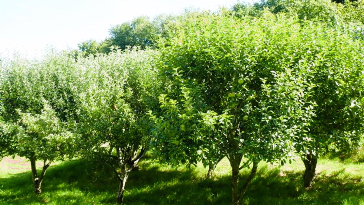
The Apple Orchard
c1e: Intensive orchards
|
|
|
A small apple orchard was planted in 2006 when the family had a fruit and vegetable garden on the west side of the meadow. Varieties include Bramley, Egremont Russet, Worcester Pearmain, Laxton’s Superb, Charles Ross and Blenheim Orange.
|
|
The Riparian Woodland
w1d: Wet woodland
|
|
|
Most of the lake banks rise uniformly out of the water leaving little space for emergent vegetation. Three small areas on the north bank of the lake have been modified to provide habitat for such wetland species, and also contain small ponds for additional species. The plants introduced to these areas include Water Forget-me-not, Marsh Marigold, Ragged Robin, Purple Loosestrife and Yellow Flag Iris.
|
|
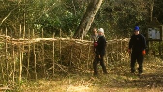
The Hedgerows
h2a: Heathland/Hedgerow
|
|
|
There are approximately 590 metres of hedgerow around the site. Some of the Hazel has been laid, thanks to Graham West and our SDNPA volunteers. We have planted over 200 metres of mixed native hedging plants from The Woodland Trust’s Trees for Schools and Communities scheme including: Holly, Hazel, Crab Apple, Downy Birch, Hawthorn, Goat Willow, Hazel, Blackthorn, Elder, Dog Rose and Rowan.
|
|